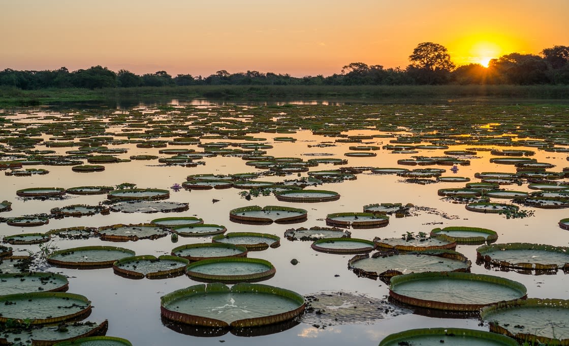
Spanning more than 42 million acres across three countries, the Pantanal is the largest tropical wetland in the world and one of its foremost wildlife hotspots. But where is located, and how do you get there? Here we take a look at the in-depth geographical and logistical features which make the Pantanal region really worth considering as you plan your vacation to Brazil.
The Pantanal is an enormous internal delta (alluvial plain) of merging rivers in the northern reaches of the Rio de la Plata Basin. Mainly found in southwest-central Brazil through the states of Mato Grosso and Mato Grosso do Sul, it also covers small sections of southeast Bolivia and northeast Paraguay.
It extends some 375 miles (600 km) north-to-south along the banks of the upper Paraguay River and several of its tributaries, including the São Lourenço and the Taquari rivers. Its exact boundaries can be difficult to define, given changing river courses and variable flooding over time. However, it is bounded by Cuiabá in the north and Porto Murtinho to the south, the central Brazilian Cerrado plateau to the east, and the Paraguay river – which drains the seasonal flooding – to the west.
For decades, the Pantanal has stayed in relative obscurity as the Amazon Rainforest dominated South America’s nature scene, but with its gaining notoriety has come some improvement in infrastructure, and is now becoming increasingly accessible for travelers and nature enthusiasts alike.

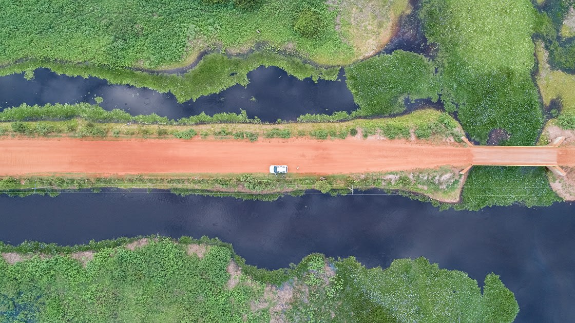
Aerial View Of Transpantaneira Dirt Road
Although more accessible now than ever, getting to and around the Pantanal can still be a challenge. This part of the world does not take kindly to spontaneity, so it is important that you have everything organized in advance when planning your trip.
Whilst the most intrepid of travelers may consider accessing the Pantanal via the smaller, more remote corners of the Pantanal from the Bolivian towns of Puerto Suarez, San Matias, and Puerto Quijarro, or the towns of Vallemí, Fuerte Olimpo, and Bahia Negra in Paraguay, undoubtedly the best access to the region is from within Brazil where the majority of the wetlands lie.
The Brazilian Pantanal can generally be split into two sections, the more aquatic northern section within Mato Grosso (roughly 1/3 of the Pantanal), and the southern section in Mato Gross do Sul (roughly 2/3 of the Pantanal) famed for its ranches. Each has its own logistics which we’ll take a look at here. Note there are just two main roads that service the entire region: the Estrada Parque for the south and the Transpantaneira for the north. Both are incredibly scenic but incredibly around 80% of the Pantanal floodplains become submerged during the rainy (flooded) season between November and February, and roads are no exception, so you may need to hop in a small plane or cruise boat to access the region.

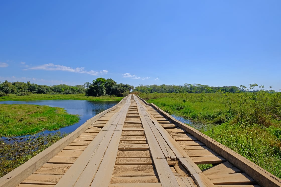
Old Damaged Wooden Bridge
If you plan on visiting the northern section of the Pantanal you will need to enter through the city of Cuiabá. Southwest of the city is a small town called Poconé, which is where you will find the start of the Transpantaneira Highway. This road runs just over 90 miles into the middle of the Pantanal region, to a place called Porto Jofre. Take note that this road is little more than a raised dirt track connected by over 100 wooden bridges.
During the rainy season, parts of the road are inaccessible so bear this in mind when planning your trip. The easiest way to get to Cuiabá is to catch a domestic flight from one of Brazil’s airports. Sao Paolo and Rio de Janeiro all have frequent connections to Cuiabá. Most people do not stay in Cuiabá as there is not a lot to do in the city itself. It is used more commonly as a jumping-off point for the Pantanal region. Generally, northern Pantanal is considered much easier to get to than its southern counterpart.

Estrada Parque Do Pantanal Dirt Road, Mato Grosso Do Sul
Campo Grande is the capital city of Mato Grosso do Sul and is the gateway to southern Pantanal. The actual entrance to the park is about 6 hours away from Campo Grande in a town called Buraco das Piranhas. From there, you will enter the Pantanal by driving along the Estrada Parque, which is a series of dirt roads. You will travel past dozens of fazendas (ranches) that double up as basic accommodation for visitors. This journey can be long and tiresome and is often avoided in favor of flying.
If you are entering from the south you have the option to take a private plane from Campo Grande directly to one of the fazendas. This is less time-consuming than navigating the dirt tracks but can be quite costly. Alternatively, you can hop in a boat from Corumbá and access the lodges this way. If you are traveling to the south part of the Pantanal, you may want to consider carrying on your journey to either the Iguazu Falls or Bolivia, as both are accessible from there.
It is no secret that when it comes to navigating the Pantanal, having an organized tour set up and private transportation is the best way to go. Now you know where to find it and how to get there, are you ready to explore Brazil’s sensational Pantanal region?
While Rainforest Cruises aim to provide accurate and up-to-date information, we make no representations as to the accuracy or completeness of any information herein or found by following any link on this site. Rainforest Cruises cannot and will not accept responsibility for any omissions or inaccuracies, or for any consequences arising therefrom, including any losses, injuries, or damages resulting from the display or use of this information.


