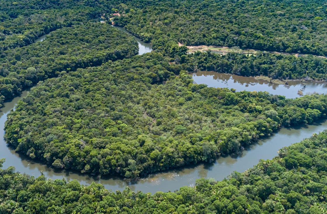
The Amazon River is located in Amazon Rainforest in the northern portion of South America. It originates high in the Andes Mountains of Peru and flows eastwards on a meandering 4,000-mile (6,400 km) journey, roughly one-third of its length in Peru and two-thirds in Brazil, before emptying into the Atlantic Ocean on Brazil’s northeastern coast.
That said the Amazon River has more than 1,100 tributaries — 17 of which themselves are over 930 miles (1,500 km) long — and so it can be argued that the Amazon River also flows in Ecuador, Bolivia, Colombia, and a small part of Venezuela too.
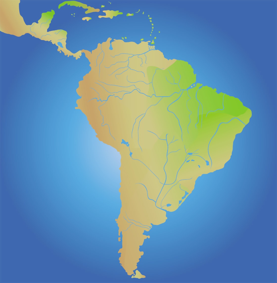
To help you better visualize where the Amazon River is please see the map of South America below. The green color is the Amazon Basin, the light blue lines the Amazon River’s tributaries and the longest dark blue line running horizontally is the main channel of the Amazon River.

South America & The Amazon River
To get the most accurate answer to where the Amazon River is located, we must ask ourselves where the Amazon River starts and ends exactly. A seemingly simple question I’m sure you’ll agree, but questions with surprisingly difficult and rather fascinating answers.
The question of where the Amazon River starts is one that has been fraught with debate for centuries and is why there is general confusion over the length of the Amazon. Historically five different rivers, all located in the Andes of Peru, have been heralded as its source, the most widely accepted being Lake Ticlla Cocha in the headwaters of the Apurimac River.
Much of the confusion arises from which of the three definitions of a river’s source is used. Is it the farthest point upstream that provides the largest volume of water, of the longest tributary in the river’s drainage basin, or of the longest tributary that flows continuously? The latter is the currently accepted definition, but this has not always been the case.
Throughout the 1700s, the Marañón River in northern Peru was considered the source as it holds the largest volume of water compared to other distant tributaries. Later, the Ucayali River, also in northern Peru, took the crown being a longer tributary than the Marañón.
In the 1930s the headwaters of the Apurimac River was the main focus of attention of many expeditions trying to find the true source, being the Amazon River’s most distant source with an uninterrupted flow. In 1935, Lake Vilafro took that title. By 1971, a National Geographic team had established that the Carhuasanta River flowing down the 5,500m high Nevado Mismi mountain in southwestern Peru was the source, but on a follow-up expedition in 2000 confirmed Lake Ticlla Cocha to be the source of the Carhuasanta River and hence the true source of the Amazon River.
Research published in 2014 in the journal Area put forth a new claim that in fact the Mantaro River, which begins north of Lima, is the source of the Amazon. Despite indeed being the farthest upstream source feeding the Amazon Basin, it does run dry for around five months of the year and so is not regarded as accurately based on the most accepted definition of a river’s source.
Measuring the length of a river might seem like a simple task but the fact of the matter is that the complete opposite is true. The easiest way to approach a question like ‘where does the Amazon River end is’ is to say that it ends in the Atlantic Ocean at Marajó Bay.
The Amazon River pumps so much water into the Atlantic that you could sail from the mouth of the river for dozens of miles in the ocean and still find freshwater, so which point should we use as the endpoint? To complicate matters further, the Amazon River has three main outlets into the Atlantic Ocean: two to the north of Marajó Island – the Northern Channel near Macapá, and the confusingly-named Southern Channel that hugs the northern coast of the island – and one even further south in Marajó Bay, passing through the Breves Channel around the western edge of the island and joining the Pará River estuary along the southern coast of Marajó Island, near Belém. The southernmost channel in Marajó Bay is used as the official endpoint of the Amazon River as it constitutes the longest distance from its source.
Amazingly if you’d asked those questions 100 million years or so ago you would have gotten a completely different answer! The reason being the Amazon River has only been flowing out into the Atlantic Ocean since then. Before this period – before the Andes Mountains had even started to rise – the river actually flowed in the opposite direction. Scientists discovered this when they unearthed river sediment that should naturally be transported downstream but was found upstream in the Amazon River. This left only one explanation: the river used to flow in reverse.
The Amazon River remains a mystery to this day, baffling scientists from all over the world with its enormity and curious tendencies. In fact, just a few years ago, a team of scientists discovered an underground river around 4km beneath the Amazon River that runs for about the same length but in some parts is around four times wider.
Now you know where the Amazon River is located and where it starts and ends, the best way to truly find out about this remarkable river is to discover it for yourself in person, and navigate its mysterious waters on an Amazon River cruise.
While Rainforest Cruises aim to provide accurate and up-to-date information, we make no representations as to the accuracy or completeness of any information herein or found by following any link on this site. Rainforest Cruises cannot and will not accept responsibility for any omissions or inaccuracies, or for any consequences arising therefrom, including any losses, injuries, or damages resulting from the display or use of this information.


